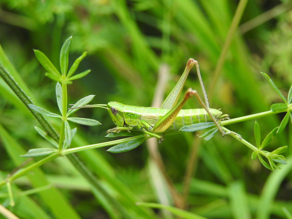
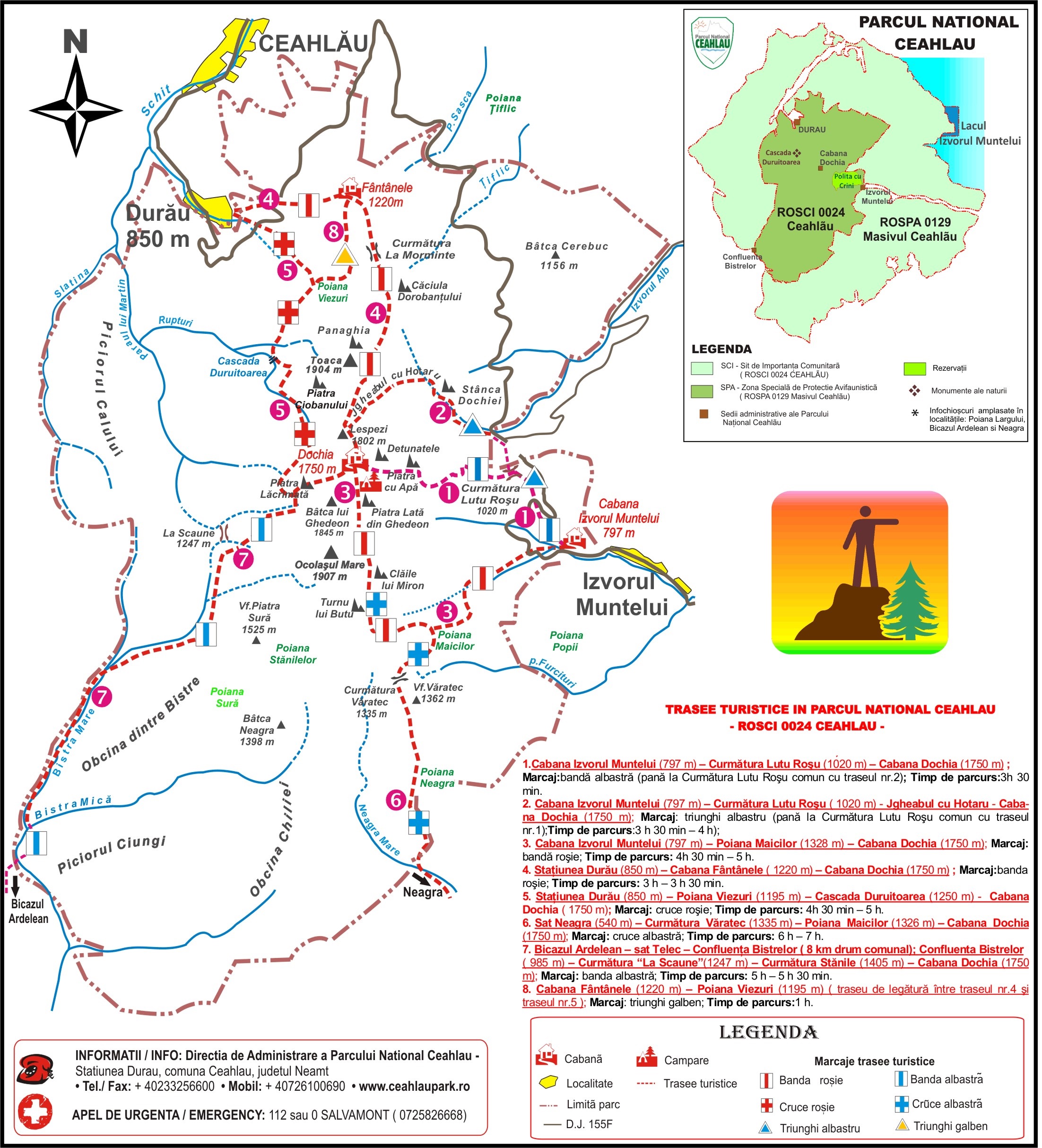
- Marking: blue triangle;
- Duration: 3 H 30 min – 4 H on the way up; 2 H 30 min on the way down;
- The difference in level is 1020 m. The length of the track is 5.7 km. The difficulty level is medium.
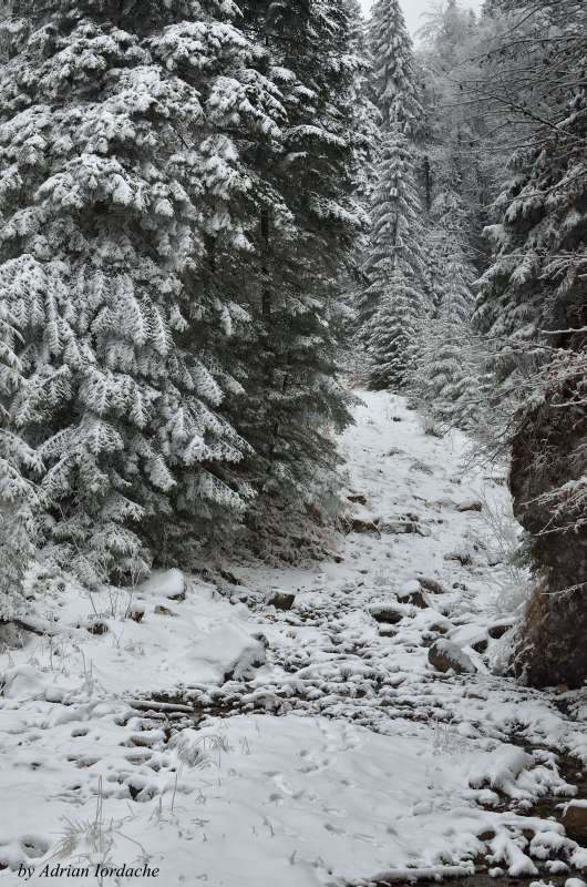
- During winter time, it is NOT recommended to follow the portion between Stanca Dochiei – Dochia Cabin
(between Izvorul Muntelui Cabin and Curmatura Lutul Rosu – La Arsuri, this track juxtaposes the first one)
The path is oriented northwards, first going through a beautiful resinous forest and continues towards Curmatura Lutul Rosu after crossing DJ 155F, slightly deviating towards the north-west. After approximately 45 minutes we reach Curmatura Lutul Rosu, in a small clearing named La Arsuri (1041 m), where a table and two benches are placed, for the purpose of a small rest.
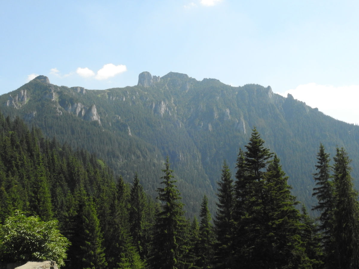
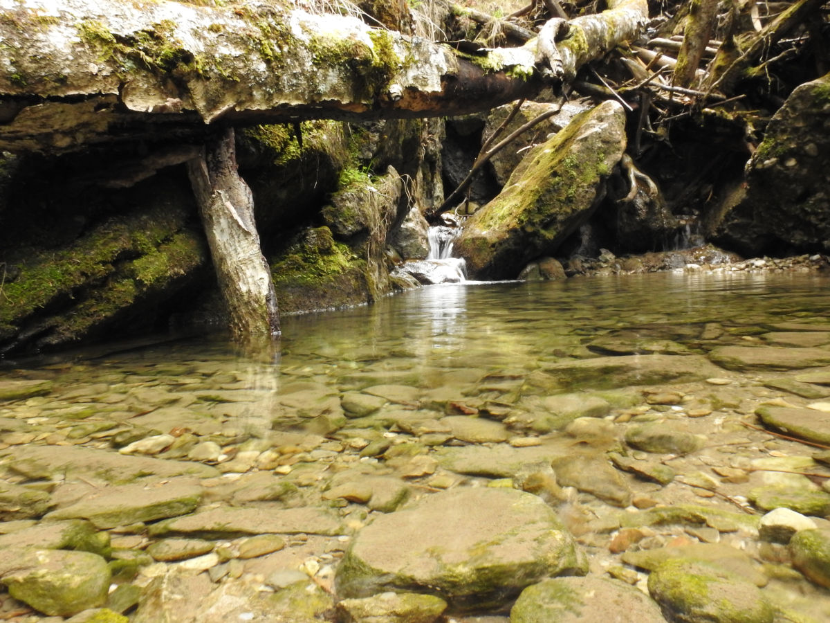
From here, we continue on the trail marked with a blue triangle, first slightly descending through the forest, and then walking circa 200 m on DJ 155F, towards Izvorul Alb river. On the horizon you can see Toaca Peak, joined on its left by Stanca Panaghiei. The forest road slowly merges into a path that continues on the light climb, crossing Izvorul Alb river in several places. After approximately 1.2 km from DJ 155F we reach Stanca DOchiei (1179 m), situated below Piciorul Sihastrului. From under the massive rock a small river makes its appearance, being ideal for water provisions, as there are no other sources until we reach Dochia Cabin.
Upwards from Stanca Dociei, in a large clearing named “La Izvoare”, Jgheabul Mare and Jgheabul cu Hotaru rivers meet. We follow the course of the latter through a dense resinous forest which, at places, opens up to a visual treat of Izvorul Muntelui Lake. The last segment through the forest is a bit more difficult, as the past sneaks in between the conglomerate blocks fallen from Ceahlau crag. We pass under Vulturul lui Traian Rock on the right and Santinela on the left, and after almost 1.2 km from Stanca Dochiei we exit the forest and enter a beautiful natural amphitheatre named Cetatea de Piatra (Stone Fortress), through Poarta de Piatra (The Stone Gate).
A toilsome path through juniper follows, under Toaca and Lespezi Peak (1805m), towards the final destination, Dochia Cabin. The effort is repaid by the beauty of the landscape. Politele Hotarelor open up to us in a panorama, flanked by Plaiesilor and Cetatuia Rocks, Creasta Hotarului and the two rocks suggestively named Good Man and Bad Man, dominated by the impressive stone arch of Toaca Peak (1904 m). The trail takes a left turn and reaches Dochia Cabin (situated at an altitude of 1760 m) after another 1.2 km from the forest exit point.
The entire track in between DJ 155F and Dochia Cabin was set up as a thematic trail during a programme named Life Natura.