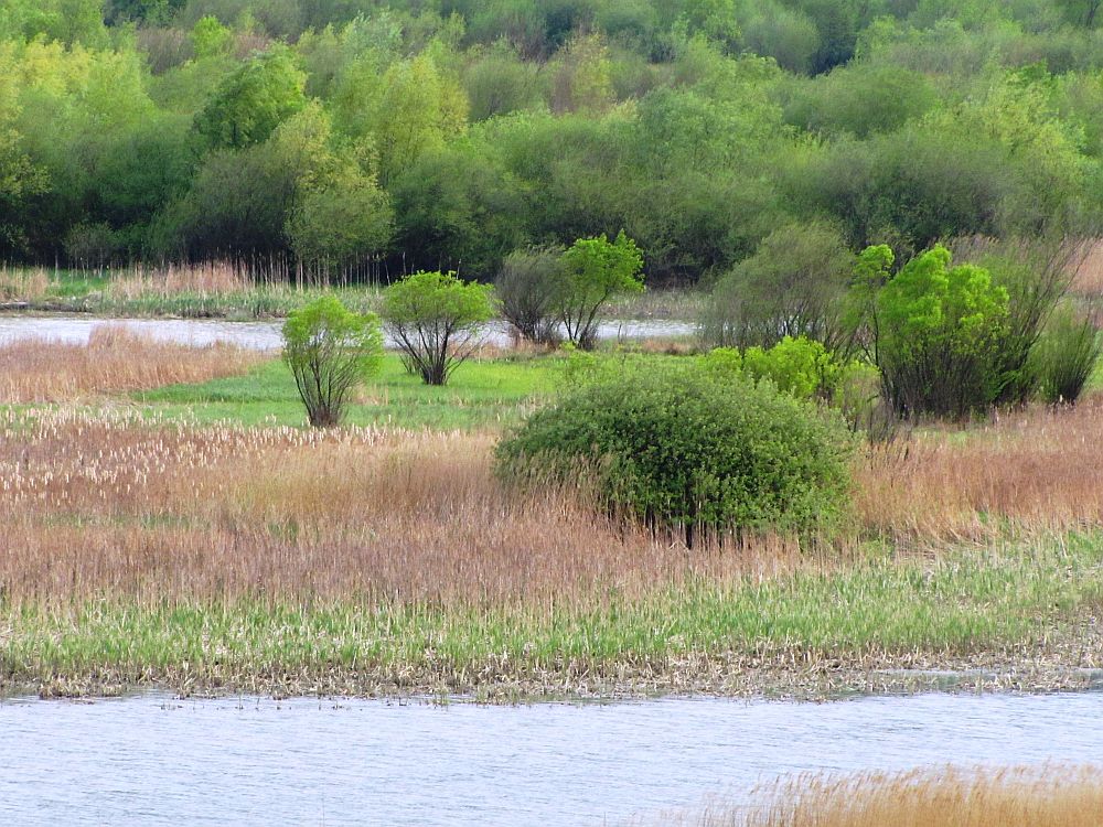
Geographical position
Vaduri, Pângăraţi and Bâtca Doamnei Lakes are situated on the course of Bistriţa Valley, downstream from the Izvorul Muntelui barrier lake and Bicaz City, between Oanţu Locality, Pângăraţi Commune and Piatra Neamţ Municipality, in the following succession: Pângăraţi, Vaduri and Bâtca Doamnei.
In this sector, Bistriţa Valley is delimited on the left by the peak of Stânişoarei Mountains and on the right by Goşmanului Mountains.
Limits
The Northern limit starts from the mouth of the spillway channel of “Stejarul” Hydro-Electric Plant; on the east it is represented by an unimproved shore until the outline dam; it continues with the outline dam, which has a length of 900 meters and connects with the front barrage that closes the lake on the east, followed by an unimproved shore from the mouth of Pângărăcior River and continuing towards the north-east until the discharge mouth of Bisericani River in the lake; the limit continues on a general south-eastern direction until it reaches the front barrage separating Vaduri lake from the old bed of Bistriţa River and the approach channel leading to Vaduri Hydro-Electric Plant, finalising with the incorporated area of Bistriţa Locality
The Eastern limit limit is represented by the body of the front barrage.
Surface
The special avifaunal protection area ROSPA0125 Vaduri and Pângăraţi Lakes spans on a surface area of 452 hectars belonging to Pângăraţi, Alexandru cel Bun Communes and Piatra Neamţ Municipality.
The Western limit is represented by the bridge built over Bistriţa River, which ensures the link between Oanţu Village and DN15; the limit continues to follow the unimproved shore until it reaches the discharge mouth of “Stejarul” Hydro-Electric Plant`s spillway channel, respectively the bridge crossing Bistriţa River on DN15 on the shoreline with an unimproved shore, until the discharge mouth of Pângărăcior River.
translated by Andrada-Cristina Dobrea